What we know Monday about North State wildfires: Crews work to keep August Complex from crossing highway
Mike Chapman Redding Record Searchlight
Published 7:08 PM EDT Sep 21, 2020
Editor's note: We have made this story free to all readers as an important public service. If you are able, please consider subscribing to support local news like this.
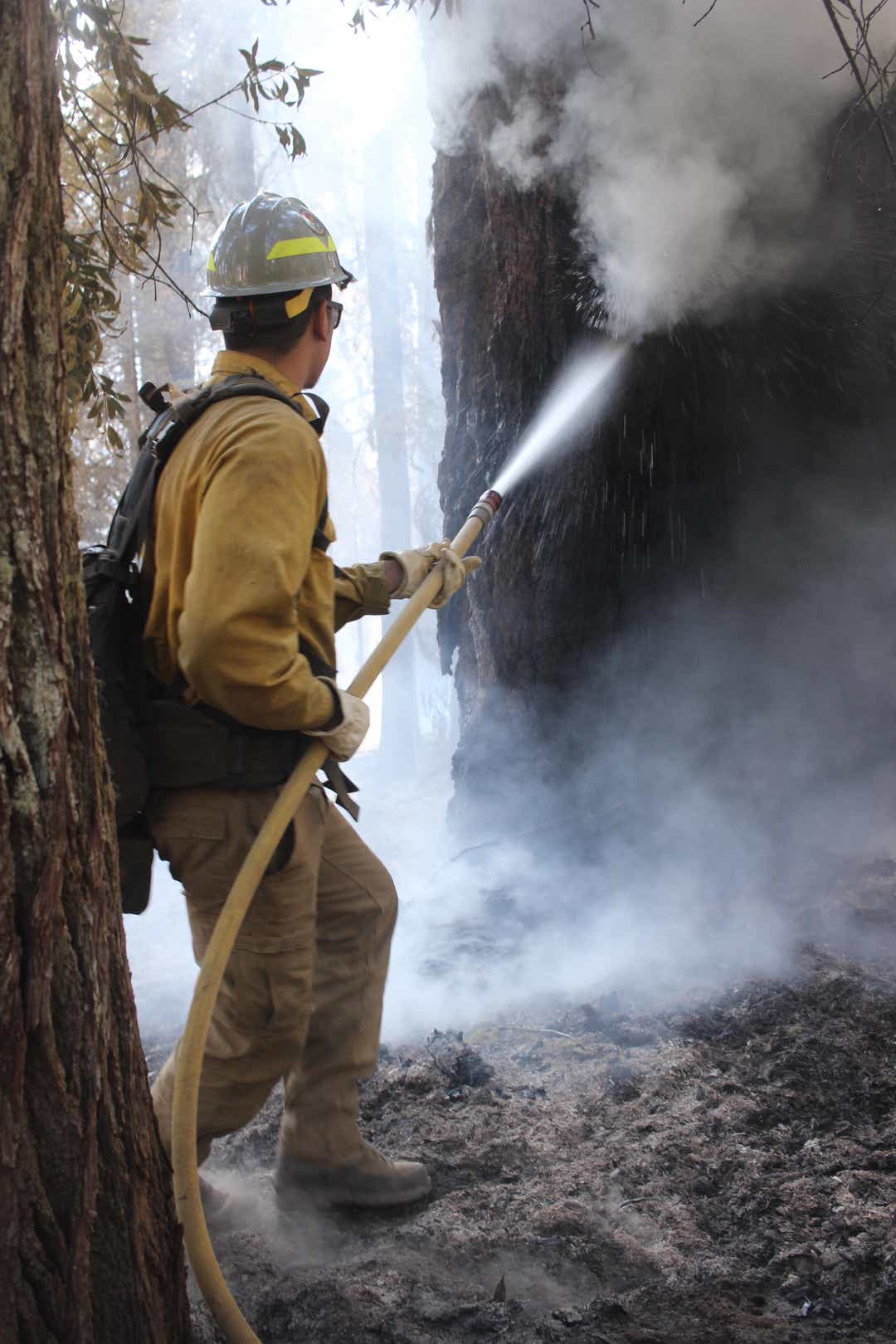
Fire crews continued their work Monday to protect homes in the northern part of the August Complex and prevent flames from crossing Highway 36.
The 846,732-acre August Complex ranks as the largest fire in California history and is burning in Tehama, Trinity, Mendocino, Humboldt, Lake and Glenn counties. The complex's huge size is due to many lightning fires merging, including the Elkhorn, Hopkins, Willow, Doe and Vinegar fires.
Containment was 34% Monday — the same as Sunday.
Wildfire maps: Here are 7 online fire maps Californians can use to stay in-the-know

At its closest, the North Zone of the complex was about 1½ miles away from Highway 36, south of Post Mountain, incident management team spokesman Mike McMillan said Monday.
The fire continued to burn slow and steady from Sunday night into Monday as crews were successful with firing operations to protect communities in the Ruth Valley, located in southern Trinity County where Ruth Lake sits.
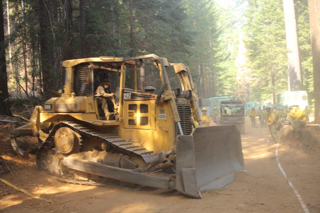
Bulldozers are being used to tie in roads and existing ridges and fortify pre-existing dozer lines to defend homes around the lake, Forest Glen and Trinity Pines/Post Mountain.
“These lines are being built in order to stop the forward progression of the fire towards this community” Incident Commander Norm McDonald said in a statement.
Those same areas, including southeast of Ruth Lake up to and including Journey's End, are under evacuation orders, although spokesman McMillan said many residents have decided to stay.
Evacuation warnings cover Mad River, Hettenshaw Valley, Zenia, Kettenpom and the north area of Ruth Lake from Journey’s End to Highway 36.
People leaving their homes are going to the Hayfork fairgrounds where they're getting directions to hotels in Lewiston or Weaverville for accommodations safer from COVID-19.
Crews also planned to build and improve control lines to the South Fork of the Trinity River from Horse Ridge.
More: Shasta-Trinity National Forest, 8 others in California get OK to reopen after fire closure
Most of the complex has burned in the Mendocino National Forest. Latest figures as of Saturday show 565,990 acres were in the Mendocino forest with 101,985 acres in Six Rivers National Forest and 82,758 acres in Shasta-Trinity National Forest.
Tall grass up to 2½ feet, chaparral brush up to 6 feet and timber have burned, contributing to the wildfire smoke that's fouled the air around Northern California.
Firefighters — more than 19,000 on the front lines – were battling 27 major wildfires in the state, Assistant Deputy Director Daniel Berlant of the California Department of Forestry and Fire Protection said in a fire summary Monday.
Since the start of the year, more than 7,900 wildfires have burned over 3.6 million acres of the state, he said. More than 6,400 structures have been destroyed and 26 people have died.

Here's a rundown of fires burning around the North State:
August Complex
- Location: Tehama, Mendocino, Humboldt, Lake, Glenn, Trinity counties
- Size: 846,732 acres (all zones as of Monday morning; West Zone at 93,776 acres and 20% contained)
- Containment: 34%
- Notes: 1 death (volunteer firefighter Diana Jones, 63, died in the fire Aug. 31); 11 injuries; largest fire in California history, third largest fire in U.S. history; 86 structures destroyed; merged fires include Elkhorn, Hopkins, Willow, Doe and Vinegar
- Incident management page: https://inciweb.nwcg.gov/incident/6983/
- Cost: $43.9 million
- Expected containment: Nov. 15, 2020
More: 'Folks, the danger is not over yet.' Fire officials update the North Complex Fire in Butte Co.
North Complex
- Location: Plumas and Butte counties, southwest of Susanville
- Size: 294,301 acres
- Containment: 64%
- Notes: A bear found injured in the West Zone of the North Complex is in guarded condition, but stable. The blaze is burning west toward the Ponderosa Reservoir and southwest down to the South Fork of the Feather River, as welll as south toward Forbestown Reservoir Road. Crews are building both direct and indirect control lines to keep the fire away from Forbestown, Woodleaf, Clipper Mills and Strawberry Valley. The fire's western and southern perimeters are holding with no fire growth expected. Some 140 California National Guard soldiers arrived Sunday to help in mopping up. Fifteen people have died and 1,784 structures have been lost.
- Incident management page: https://www.fire.ca.gov/incidents/2020/8/18/north-complex-fire/
- Cost: $91.4 million
More: Amid destruction, firefighter rescues 'fire cat' as it runs to him for safety
Slater/Devil Fires
- Location: Siskiyou, Del Norte, Josephine (Oregon) counties
- Size: 156,043 acres (148,585 Slater; 7,458 Devil)
- Containment: 22% for Slater, 18% for Devil
- Notes: Two fatalities, 150 residences destroyed, 11 structures damaged, 5,058 structures threatened. Residents next to the Cave Junction, Oregon, city limits remain at a Level 1 "be ready to evacuate" level. Wildland crews are continuing to establish control lines, including along Highway 199 to protect Gasquet in Del Norte County. Crews are digging line alont the fire's north side, south of Cave Junction, Takilma, Sun Star and over to Browntown. The Slater Fire to the south is mainly in mop-up and patrol status. Evacuation warnings were lifted Monday for the town of Happy Camp, Seiad and Elk Creek area. Evacuations remain for Indian Creek Road and Indian Creek Meadows, where the roads are closed.
- Cost: $14.1 million ($14 million Slater, $100,000 Devil)
- Incident management page: https://inciweb.nwcg.gov/incident/7173/
Fox Fire
- Location: Siskiyou County, Callahan area
- Size: 2,029 acres
- Containment: 31%
- Notes: No significant fire activity from Sunday night into Monday. The fire is holding south of Forest Road 40N17 as crews continue to build a control line into the Trinity Alps. Evacuations have been lifted for west of Callahan at the South Fork of the Scott River, but an evacuation warning remains. The Fox Lake Trail and Forest Service Road 40N17 remain closed along with the Klamath National Forest until Sept. 24.
- Cost: $1 million
- Incident management page: https://inciweb.nwcg.gov/incident/7203/
More: These 10 charities can help those most affected by wildfire burning in the North State
Red Salmon Complex
- Location: Trinity and Humboldt counties, northeast of Willow Creek mainly in the Trinity Alps Wilderness Area
- Size: 104,587
- Containment: 20%
- Notes: Monday was Day 56. Crews are working to build control lines while waiting for the right weather conditions to do firing operations. The southwest section remains active. As the air clears, helicopter pilots are dropping buckets of water on key hot spots. Hose lays, pumps and other structure-protection measures remain in Denny and Forks of Salmon. An evacuation warning in effect for Forks of Salmon.
- Cost: $65.4 million
- Expected containment: Sept. 30, 2020
Incident management page: https://inciweb.nwcg.gov/incident/article/6891/56526/
Mike Chapman is a reporter and photographer for the Record Searchlight in Redding, Calif. His newspaper career spans Yreka and Eureka in Northern California and Bellingham, Wash. Follow him on Twitter @mikechapman_RS. Subscribe today!
tinyurlis.gdu.nuclck.ruulvis.netshrtco.de
