Hurricane Isaias: Here's what to expect from the storm on Treasure Coast
Staff report
Published 1:57 PM EDT Jul 31, 2020
Hurricane Isaias (ees-ah-EE-ahs) is the ninth named storm for 2020, which usually usually doesn't arrive until October, weather officials said.
As of noon Friday, Isaias was forecast to remain a Category 1 hurricane as it moves toward Florida. It's expected to be just offshore the Treasure Coast Saturday night, and just offshore of Brevard County by Sunday morning, according to Treasure Coast emergency management officials.
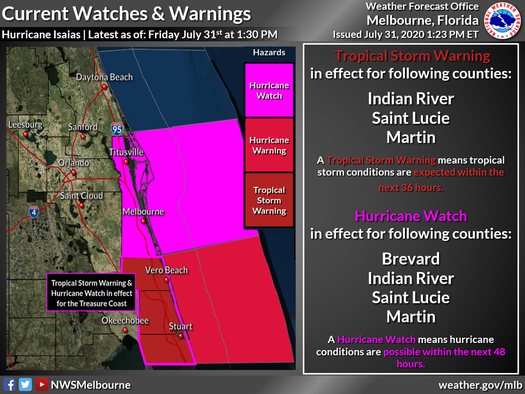
Because of the approach of Hurricane Isaias, a hurricane watch has been issued for the Treasure Coast and Brevard County.
More: Update: Hurricane Isaias weakens slightly; hurricane watches issued for east coast of Florida
More: Treasure Coast residents prepare for Hurricane Isaias
A hurricane watch means hurricane conditions (sustained winds of at least 74 mph) are possible within the area. It is issued 48 hours in advance of the anticipated onset of tropical-storm-force winds in an area.
A tropical storm warning also is in effect for Indian River, St. Lucie and Martin counties.
A tropical storm warning means conditions (sustained winds of 39 to 73 mph) are expected within the area within 36 hours.

More: Hurricane Isaias brings Weather Channel to Vero Beach
As of Friday, possible impacts to the Treasure Coast over the weekend are:
- Rainfall amounts may reach 3 to 5 inches across the coastal counties.
- Tropical storm force winds: Peak wind speed forecast is 35-50 mph with gusts to 70 mph.
- Dangerous rip currents expected to develop Friday.
For complete coverage of Hurricane Isaias, stick with TCPalm.com. Consider supporting local journalism by subscribing.

tinyurlis.gdu.nuclck.ruulvis.netshrtco.de
